Brunel University Research Archive(BURA) preserves and enables easy and open access to all
types of digital content. It showcases Brunel's research outputs.
Research contained within BURA is open access, although some publications may be subject
to publisher imposed embargoes. All awarded PhD theses are also archived on BURA.
Please use this identifier to cite or link to this item:
http://bura.brunel.ac.uk/handle/2438/4296| Title: | High-resolution palynological analysis in Lake Sapanca as a tool to detect recent earthquakes on the North Anatolian Fault |
| Authors: | Leroy, SAG Boyraz, S Gürbüz, A |
| Issue Date: | 2009 |
| Publisher: | Elsevier |
| Citation: | Quaternary Science Reviews. 28 (25-26) 2616-2632 |
| Abstract: | High-resolution palynological analysis of a 38-cm-long core collected from Lake Sapanca, northwest Turkey, reveals large earthquakes that occurred during the second half of the 20th century along the North Anatolian Fault Zone. Four events have disturbed the lacustrine sedimentary sequence. Three of the four events are historical earthquakes in 1999 in Izmit, 1967 in Mudurnu and 1957 in Abant. These events are recorded in the core by turbiditic deposits and reworked sediment and by low overall palynomorph concentrations but high values of thick-exined pollen, fern spores and fungal spores. Palynomorphs in the event beds have been grouped based on their associations in modern moss, river and lake samples. The inferred mechanisms of transport and sources for the palynomorphs are: 1- lake sediment displaced by slump, 2- collapsed shoreline sediment owing to seiche, waves and sudden lake level changes, 3- subsidence of deltas and 4- river-transported soil and sediment from upland areas. The 1999 Izmit earthquake is only weakly recorded by palynomorphs, probably due to recent engineering control on the rivers. The 1967 Mudurnu earthquake had the strongest effect on the lake, introducing successive packages of sediment to the centre of the lake from underwater slopes, the lakeshore and rivers. |
| URI: | http://bura.brunel.ac.uk/handle/2438/4296 |
| ISSN: | 0277-3791 |
| Appears in Collections: | Environment Institute for the Environment |
Files in This Item:
| File | Description | Size | Format | |
|---|---|---|---|---|
| Palyn anal core SA03K7_QSR.pdf | 189.37 kB | Adobe PDF | View/Open | |
| fig 1 sa po.jpg | 123.89 kB | JPEG | 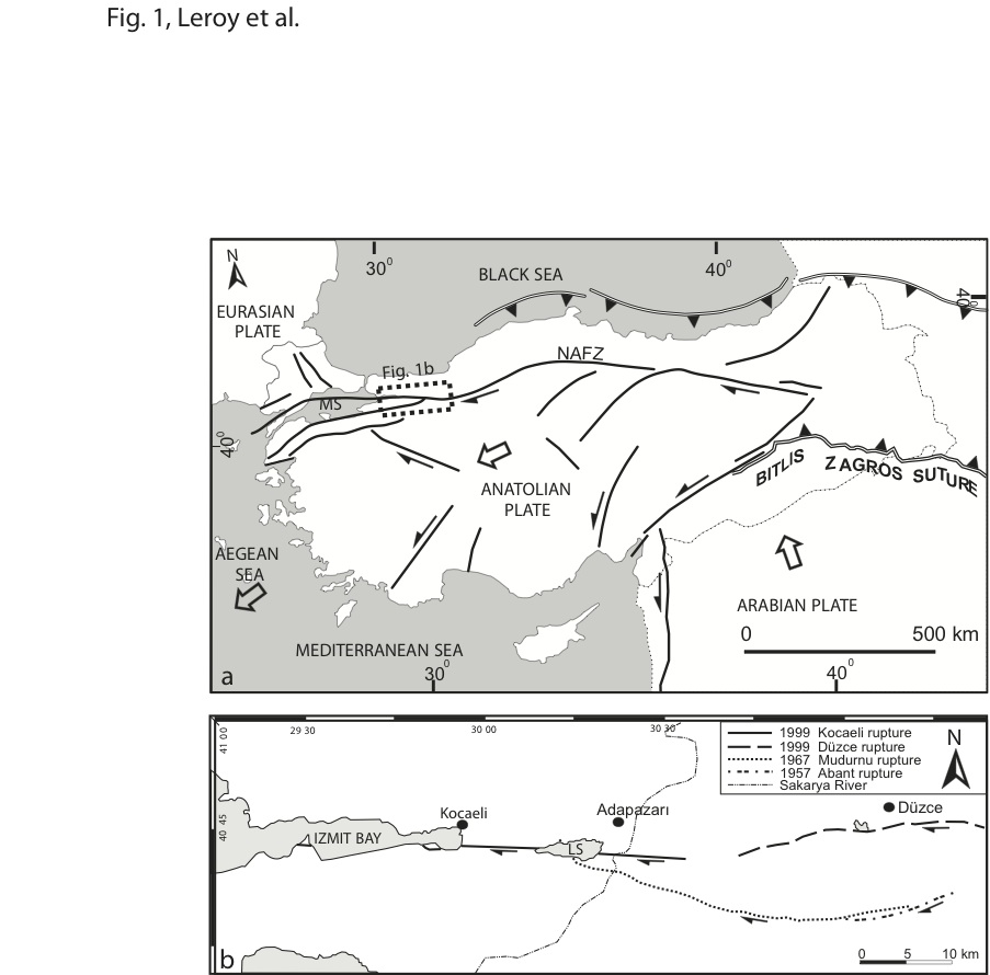 View/Open | |
| fig 2.jpg | 78.19 kB | JPEG |  View/Open | |
| fig 3.jpg | 164.78 kB | JPEG | 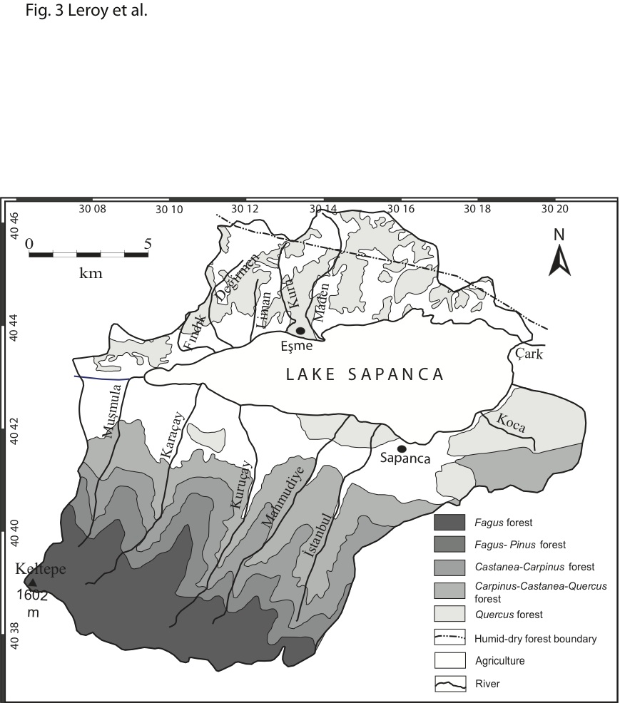 View/Open | |
| fig 4 p1.jpg | 239.35 kB | JPEG | 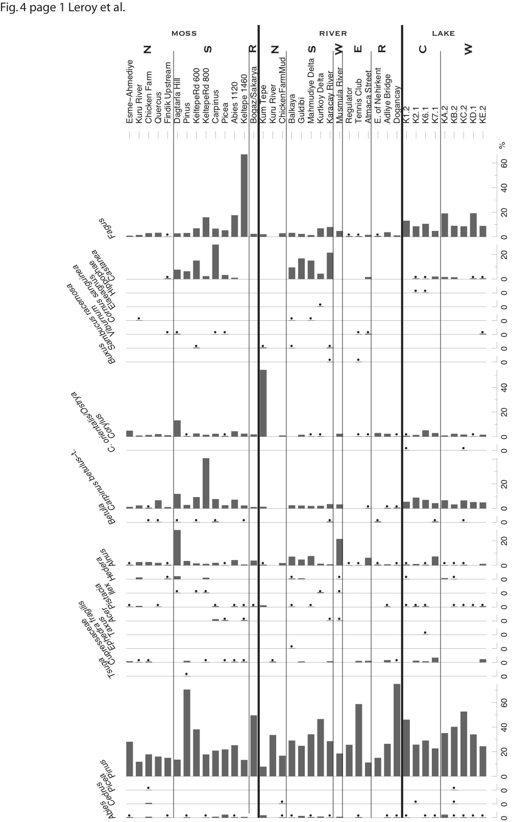 View/Open | |
| fig 4 p2.jpg | 284.78 kB | JPEG | 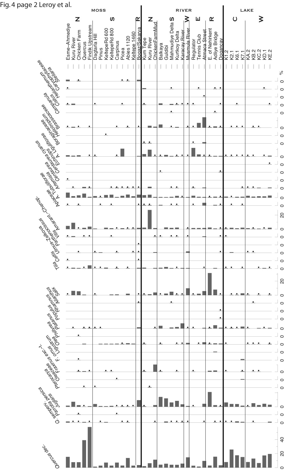 View/Open | |
| fig 4 p3.jpg | 324.39 kB | JPEG | 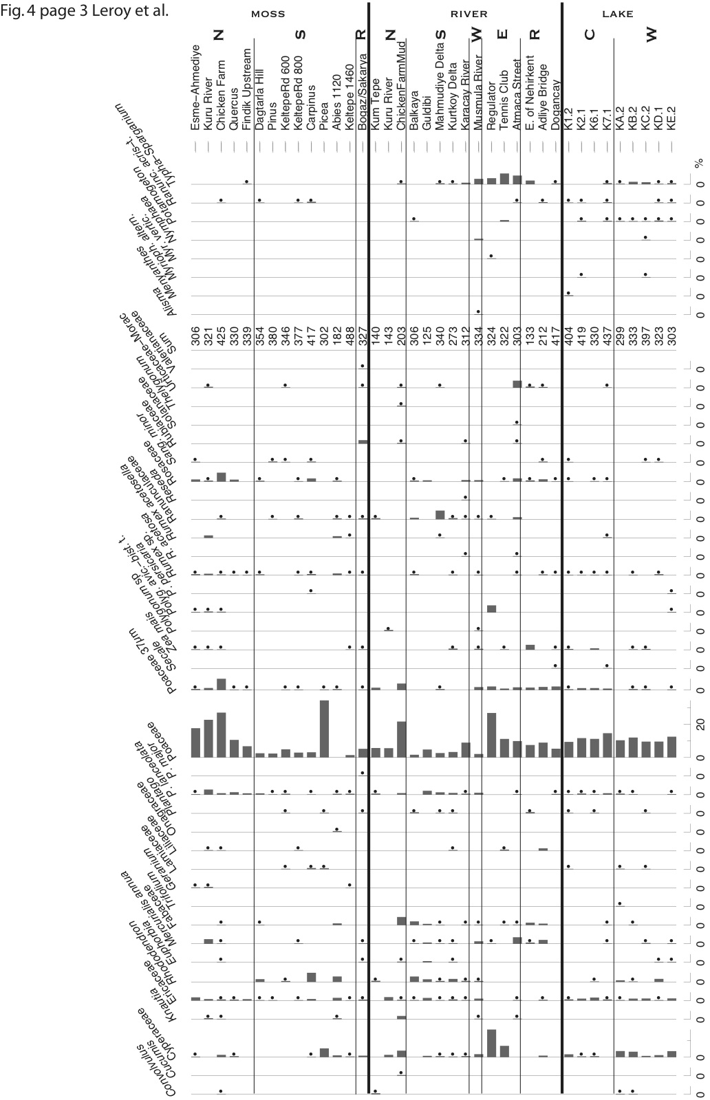 View/Open | |
| fig 4 p4.jpg | 282.89 kB | JPEG |  View/Open | |
| fig 5 p1.jpg | 306.42 kB | JPEG | 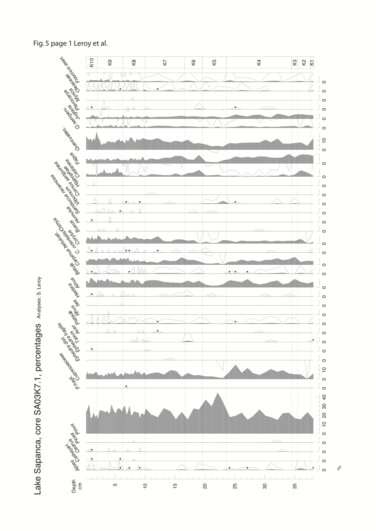 View/Open | |
| fig 5 p2.jpg | 318.06 kB | JPEG | 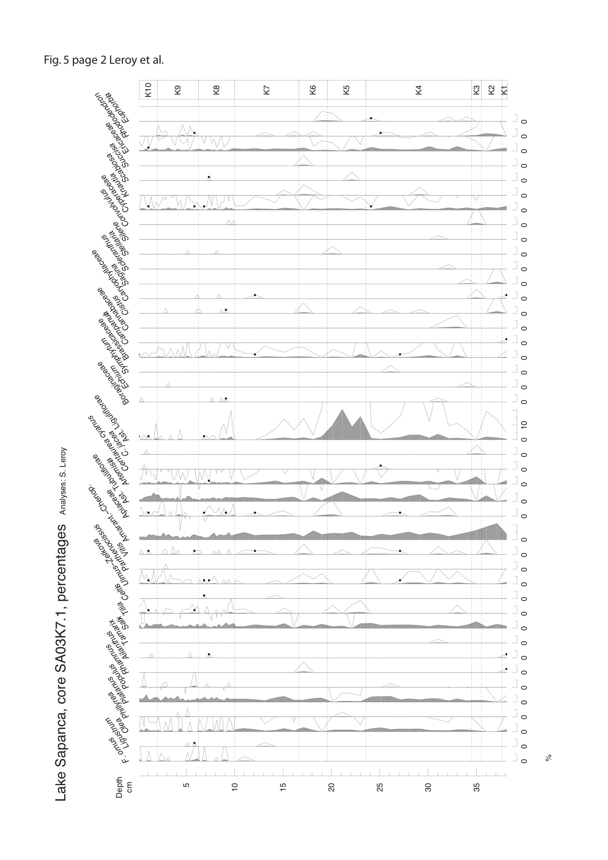 View/Open | |
| fig 5 p3.jpg | 330.53 kB | JPEG | 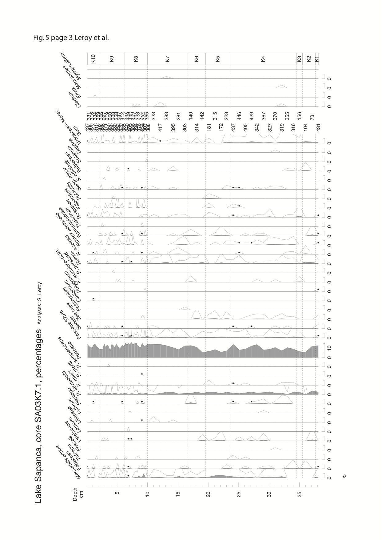 View/Open | |
| fig 5 p5.jpg | 192.89 kB | JPEG | 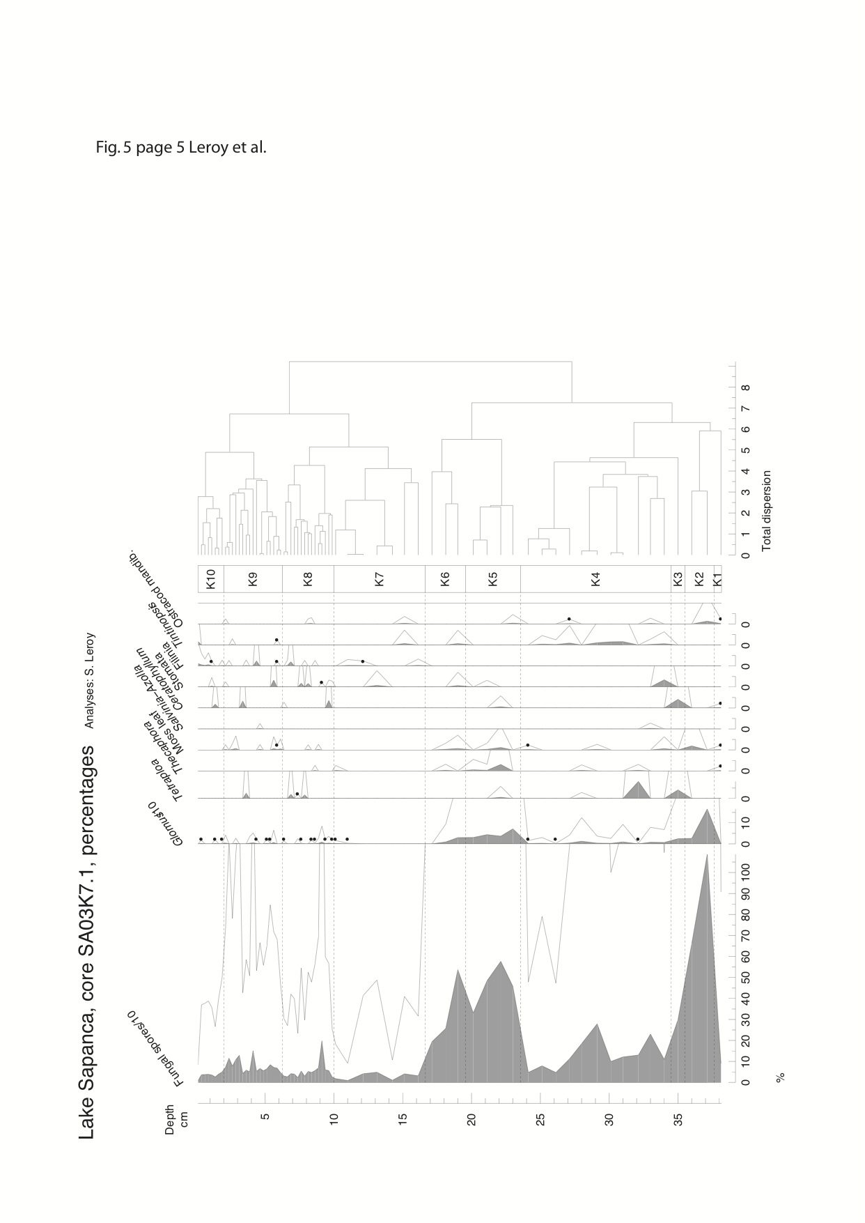 View/Open | |
| fig 5 p 4.jpg | 325.71 kB | JPEG | 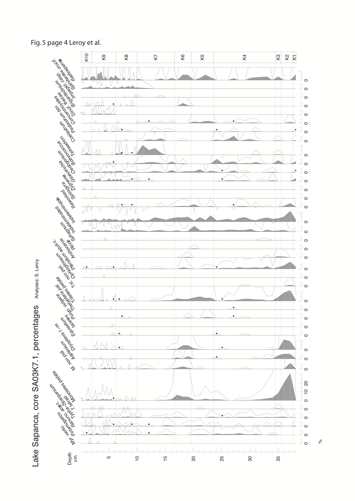 View/Open | |
| fig 6.jpg | 152.98 kB | JPEG |  View/Open | |
| fig 7a.jpg | 255.33 kB | JPEG | 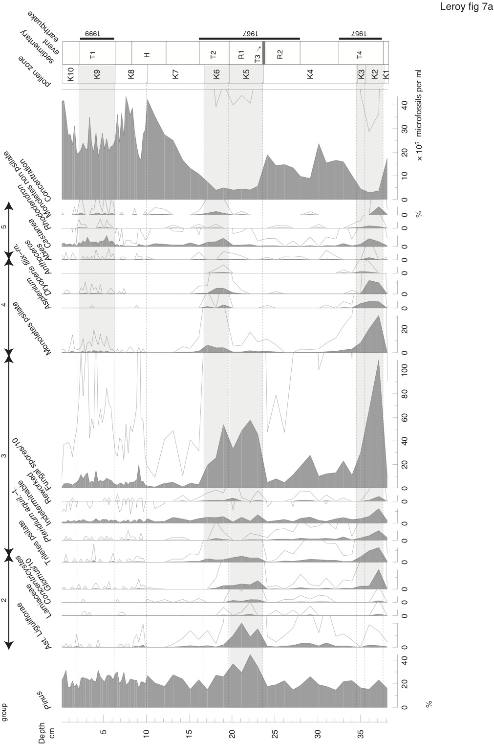 View/Open | |
| fig 7b.jpg | 229.01 kB | JPEG |  View/Open | |
| fig 8.jpg | 110.61 kB | JPEG | 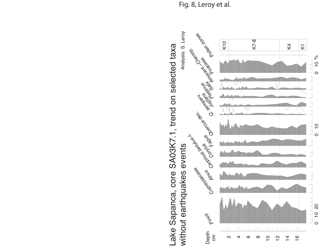 View/Open | |
| fig 9.jpg | 41.36 kB | JPEG | 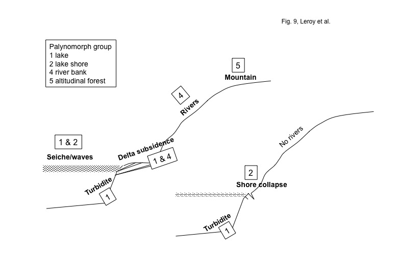 View/Open | |
| table 1 locations.xls | 47.5 kB | Microsoft Excel | View/Open |
Items in BURA are protected by copyright, with all rights reserved, unless otherwise indicated.